


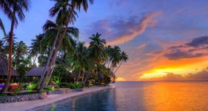
About Sun Coast Activities
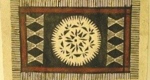
Suncoast activities and attractions are abundant… dramatic peaks, rolling hills, rushing waterfalls, traditional villages, colonial market towns, white sand beaches and pristine stands of native forest and the “Black Christ” a world class fresco at Naiserelagi by Jean Charlot.
The Sun coast begins at Vuda Point, extending east along the Kings road towards Rakiraki. If you’re renting a car, take note…
Lololo Pine Forest

Pronounced Lo-lolo, this picnic area is nestled in a pine forest north of Lautoka on the edge of a large creek. With plenty of picnic tables, it is a good place to get above the heat of the coast in summer time.
From there you could also visit a forest fire watch station, which offers an incredible view of the north-west side of Viti Levu and the Yasawa Islands off the coast. The trip is worthwhile only on a clear day because the road is very rough and not recommended for small cars or vehicles loaded down with passengers or luggage. To get to there, go past the picnic area to an intersection at the center of the station. Take a left turn and follow the road to the top of the mountain; the fire tower will be on the left.
Getting There & Away
To get to the Lololo Pine Forest, take the Lololo bus from Lautoka bus station. They run several times a day, but make sure you check the time for the last returning bus, and then get to the stop a few minutes early.
If you’re traveling by car or motorcycle head east on Kings Rd about 10 km from Lautoka, and look for the sign on the left side of the road pointing to the right-hand turn-off. Follow the road until you come to the large timber yard at Drasa. Just past the yard, the road forks. Bear left down a steep hill and follow the road until you reach the edge of the pine forest. You’ll see the picnic area on the right. The distance from the main road to the pine station is about eight km. Map
Ba

A classic, Indian sugar town 62 km from Nadi Airport that most tourists drive through. While the town’s economy has always revolved around sugar, in recent years several small manufacturing firms have started up here. A walk through the main shopping area shows you what a ‘blue collar’ community this is. The Rarawai Sugar Mill is on the edge of Ba. The most noticeable landmark in town is the large mosque near the Ba River in the center of town. Map
Tavua
This is a relaxed market town 91 km from Nadi Airport where you can catch buses for Vatukoula and Nadarivatu. The Tavua town market is a good place to stock up on fresh fruit. If you plan to spend time in Nadarivatu, this is the last chance to buy supplies. Activities on offer include picnic trips to a nearby sandy beach, and to the Vatukoula gold mines area, as well as barbecues and lovo with entertainment on the terrace. In nearby Vatukoula, one can play tennis, golf and bowls. Map
Inland From Ba & Tavua

Navala
The picturesque village of Navala, one of the last in Viti Levu with thatched roofs, is a two-hour, 26-km drive on rough road into the mountains above Ba. Your best bets for transport are a 4WD or a trail bike. The road is passable by ordinary car but the going can be brutal. From Navala it is possible to continue on to Bukuya, where the road forks either to the Sigatoka Valley (it’s about 66 km to Sigatoka at this point) or the Nausori Highlands and continues on to Nadi.
These are all-day drives, so pack food and be sure to have a full tank of fuel. For motorcyclists it is possible to purchase ‘white benzene’ from some of the village shops if needed. Like most villages, it’s not a good idea to visit Navala on Sunday. The villagers in this neck of the woods are very religious and most people are in church or in repose most of the day. Even if it’s not Sunday, don’t simply stroll into a village and begin taking photos. The local chief will not be charmed. Your best bet is to stop short (on the Ba side of the road) and shoot from across the river – which gives you a great perspective.

To get to Navala, from the Ba side of the bridge make a right turn on Rarawai Rd. Turn left at the next junction, just outside the sugar mill. Follow the road about two km where it forks and take the right fork.
An interesting alternative to the Kings Rd to Tavua and Vatukoula is the Ba Back Road. Along this road are sugar cane farms, rural Indian settlements and schools. To find this road, follow the directions to Navala, as far as the fork in the road, and take the left fork. Map
Vatukoula
Nine km inland from Tavua is Vatukoula, a gold-mining settlement established in 1934 and one of the last bastions of colonialism in Fiji. Back in the day the expatriate ran the private clubs, bowling greens and golf course. Not so now.

Gold is mined here both open-cut style and underground, with one tunnel allegedly extending way out under Tavua Bay. There are excursions to Vatukoula with Rosie Tours, but it is not possible to visit the actual mine. Gold is the country’s third-largest source of hard currency, behind tourism and sugar cane.
Gold was discovered at Vatukoula in Fiji in the early 1930’s when prospector Bill Borthwick panned alluvial gold in the Nasivi river. During the next 20 years, three companies dominated gold production In the Vatukoula region, with Emperor Gold Mining Company Limited eventually securing ownership of the whole field in the 1950’s. Vatukoula is a low-sulphidation epithermal gold deposit associated with alkaline type igneous rocks in a volcanic setting. Raki RakiRaki Raki. This volcanic setting and rock type is typical of several major gold mines in the southwest Pacific region such as Porgera and Lihir. The ore deposits lie along the margin of the Tavua volcanic caldera and consist of various types of quartz-adularia-telluride-auriferous-pyrite fillings deposited in fractured, faulted and shattered volcanic rocks. Volcanism commenced about 5 million years ago and ceased about 3.5 million years ago. The ore bodies were the last major geological event and mineralized fractures persist throughout the very late stage sediments that filled in the central part of the Caldera. ( Map
Nadarivatu

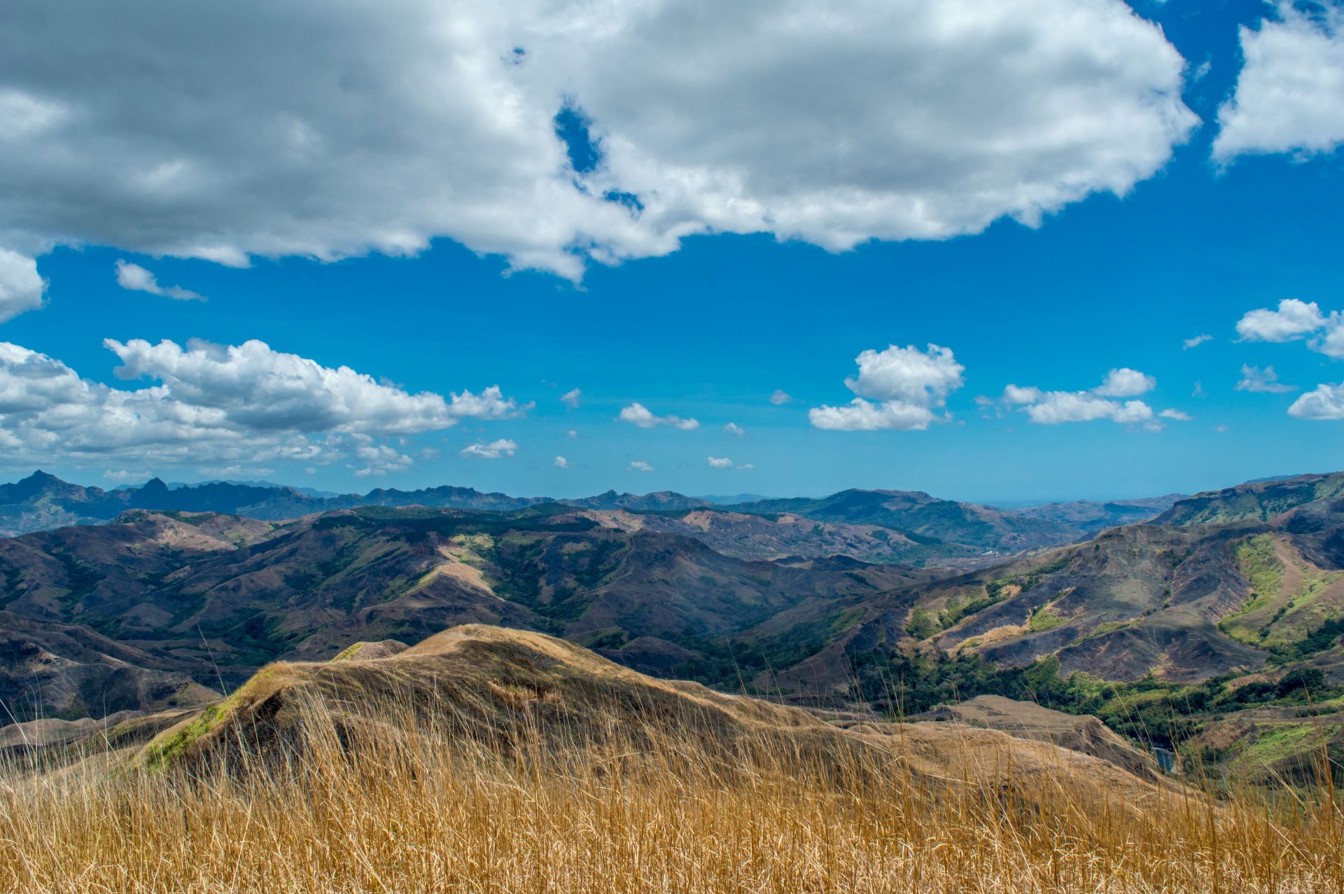
Approximately 30 km from Tavua is Nadarivatu, one of the nicest mountain getaways in Viti Levu. High in the mountains above the heat and surrounded by pine forests, the highlands of Nadarivatu are a far cry from the stereotypical South Seas featured in most brochures. Unfortunately, the pine forest is a commercial concern, and it was clear-felled early in 1992, leaving a shockingly bald landscape in many areas which were formerly luxuriant. The area will be replanted, and in a few years will look like a forest again. But aside from this ugly reminder of economic realities, Nadarivatu is a beautiful and refreshing area.
As the road winds up the escarpment, the views become more and more stunning, until at the top you can see across patchwork hills, beyond Vatukoula and Tavua on the coastal plain to the Yasawa Islands, Ovalau, and on the clearest days even to Vanua Levu. Regardless of how stifling the weather is on the coast, bring a sweater or jacket if you plan to visit Nadarivatu during early morning, late afternoon or evening; it gets very cold, even during summer.
Nadarivatu translates as ‘stone bowl’. According to Fiji resident, Peter Taylor, the most convincing explanation of ‘the stone bowl’ is a rock with a bowl-shaped depression near the forestry station on the road to Navai. It is said that until relatively recent times, a spring issued from that ‘bowl’ and eventually became the mighty Sigatoka River.

Now, however, only a fragment remains. There is an excellent description of the rock and legend associated with it in the Hill Tribes of Fiji, Brewster’s classic account of life in this area.
Nadarivatu ‘village’ is actually a government station, and all of its residents are there to provide services to the area. It is clean and neat and well maintained, and it sparkles in the sunshine like the very essence of health. However, a doctor is posted there, in case of need. (Aerial shot of Nadarivatu Dam above courtesy of Aspect Architectural Modelmakers, Dunedin, NZ)
From Vatukoula, follow the main road through the town, turn left at the ‘T’ intersection, then right at the next junction. This road will take you on a dramatic 366-metre climb to the Nadarivatu Plateau. If you decide not to go to Nadarivatu via Vatukoula, the main highway to Nadarivatu is 2-1/2 km east of Tavua on Kings Rd. A large sign marks the road on the right if you are coming from Tavua. If you are coming west from Rakiraki the sign is not so apparent, so keep an eye out.

There is also a Sunbeam bus from Tavua at 2.30 pm. It is the only bus up the mountain and does not return until the following morning. The fare is about F$2 at the Sunbeam office across the street from the market. (Note: the bus fills up quickly some days, so try to get there early for a choice seat.) The bus chugs and grinds as it slowly climbs, but fear not, it almost always makes it. Just enjoy the scenery from the open-air ‘windows’. Keep your sweater handy for the often-chilly end of the ride.
On the way to Nadarivatu there is a pleasant waterfall worth seeing; look for a culvert crossing a deep boulder-choked gorge about a km before the village of Waikubukubu. The waterfall is about 20 meters above the crossing. In the wet season you can’t miss it, as the stream rushes a few cm deep across the roadway. Map
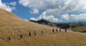
Hike to Fire Watch
One of the nicest short hikes you can take in Nadarivatu is a three-km trek to the fire-watch post on the mountaintop behind the forestry station. The post is easily seen at the sharp corner just after you crest the escarpment. Follow the trail past the training center to the governor general’s swimming hole. From there the trail winds through dense vegetation to the peak. The view from the top is fantastic, but try to make it in the morning before the clouds move in. Don’t be tempted to stop at the swimming hole, as it has not been maintained and is no longer usable (anyway, the water used to be unbearably cold). Allow 2-1/2 hours for the climb there and back.
Hike to Tomanivi
")
About 10 km beyond the Forestry Rest House is Tomanivi (Mt Victoria), Fiji’s highest peak at 1323 meters. Three large rivers originate in the shadow of this mountain: the Sigatoka, and the Wainimala and Wainibuka, which eventually join to form the Rewa River. The bridge in Navai village (about 10 km past Nadarivatu) is where the trail begins. Do not confuse the bridge in the village with the large bridge about a km before the village proper. (There is now an official marked trailhead about 200 meters before the village so as to avoid confusion.)
Follow a wide track about 100 meters and take the trail on the right to the top. Stay on the main trail – markers pointing elsewhere may be misleading. The top is almost continuously cloud-covered, so don’t expect a great view. However, you will be able to tell your friends that you hiked to the summit of the highest mountain in Fiji. For the botanically minded, the various layers of vegetation types are fascinating (especially the cloud forest layer). Allow five to six hours for the climb.
If you’re interested in hiking up Mt Tomanivi , check out our page on trekking or if you’re interested in guided, overnight trips contact Talanoa Treks which departs out of the Ra area for hikes to the interior.
Navai
Currently, Navai is a major agricultural area, producing lettuce, cauliflower, cabbage and carrots, which thrive here because of the cool climate. Most are sent to the various town markets, but there is one roadside stand with beautiful fresh vegetables most days. (If there are no vegetables on the stand, ask at the house behind it – maybe they’ll pick some fresh from the garden for you.) In 1938, during the colonial era, a potato-growing scheme was established in the Navai area, but the program failed due to plant disease. New varieties of potatoes have been introduced, and some farmers are successfully growing them again. Map
Koro-ni-O
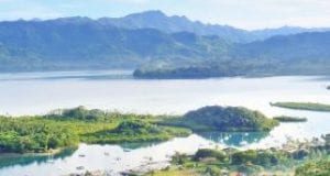
Another 25 km down the road from Navai is Koro-ni-O or ‘village of clouds’, an apt name. Today this area is headquarters for the F$234-million Monasavu hydroelectric scheme, the largest development project ever undertaken by the Fijian government.
Designed to reduce the country’s dependency on imported fuels, the project was begun in 1978 and completed in 1983. The most visible part of the scheme is the 82-metre-high earth-filled dam built on the Nanuka River, and its accompanying 17-km-long lake, cradled in the Nadrau Plateau, about 1000 meters above sea level in the mountains of central Viti Levu. This lake is the larger of Fiji’s two lakes (the other is on Taveuni). Fishing is possible in this lake if Malayan carp (tilapia) is to your liking.
About 625 meters below the level of the dam is the Wailoa River power station – connected to the dam via a 5.4-km tunnel which forces water through a series of four 20-megawatt turbines. Overhead transmission lines then carry the relatively cheap electricity to Suva and to Lautoka in the west.
Getting There & Away
There are no longer buses from Koro-ni-O to Suva across theinterior of the island. If you’re thinking of driving this stretch with an ordinary car this is one of the worst roads on the island and the rental agency will not let you near their cars if they catch wind of your plans. Though rough, it is an interesting ride and if you really want to do it, negotiate with a carrier.
Yaqara
Halfway between Tavua and Rakiraki, and 107 km from Nadi Airport is Yaqara, Fiji’s biggest cattle ranch – a 7000-hectare estate with 7000 head of cattle. Visitors should not be surprised to see Fijian cowhands in Western hats rounding up cattle. Map
Rakiraki
The road from Tavua to Rakiraki and beyond is now sealed. About 10 km before Rakiraki, watch for Navatu Rock. It is a large precipice near the road, at Vitawa village. There is only one access route to the top, making this a very defensible site for a village in hostile olden days. And there is evidence that it was one of the original sites of Fijian habitation. Pottery excavated at the base of the rock dates back about 3000 years. Predictably, there are many legends associated with this rock and with this area.

Also note the small island about 1-1/2 km from the coast, jutting about 180 meters from sea level. Fijian legend holds that this is the departure point for disembodied spirits journeying into the afterlife. In ancient times there was a village at the top of this peak.
Rakiraki is at a point roughly halfway (about 120 km) along Kings Rd from Nadi, and is a good overnighting spot for those touring the northern coast.
If locals tell you Rakiraki is where you can refuel, get a tire repaired or buy supplies for your stay at Nananu-i-Ra Island, they are really referring to the town of Vaileka, which is a km off Kings Rd. There is a well-marked triangle with a sign pointing toward Suva, and another to Vaileka.

Just prior to the triangle, on the south side of the road, is Ratu Udre Udre’s tomb. The fabled Ratu was a chief famous for his appetite for human flesh, and is said to have consumed over 800 human beings before his death in the mid-19th century. The stones surrounding the base of his tomb are how he kept tally of his grisly meals.
Ellington Wharf Turn-Off
This junction is about five km past the Rakiraki Hotel. From the wharf you can catch the boat to Nananu-i-Ra and ferries to the outer islands. See the Getting Around chapter for more information.
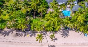
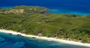
Nananu-I-Ra
This island has become very popular with visitors who wish to visit a more natural setting and get away from the commercialism of the Nadi area without traveling too far. The island is pretty and has beaches, snorkeling and good shelling. It’s five km off the Rakiraki coast, 150 km from the airport along Kings Rd.

There are several good self-contained places to stay such as Betham’s and McDonald’s (pictured above courtesy of Wikipedia) but you will need to bring groceries–there are no shops on the island. (Vaileka has a market and several shops which sell groceries, but you’ll find a better selection elsewhere, like Tavua or one of the cities.) Linen, a refrigerator and cooking implements are provided at the resorts.
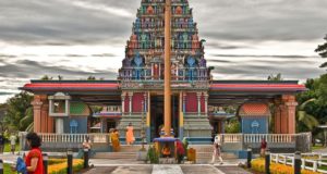
Naiserelagi
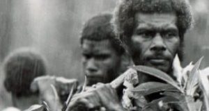
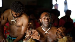
Black Christ Fresco
Naiserelagi, about 45 km east of Rakiraki, is the home of the “Black Christ” by famed French artist Jean Charlot. This is an exquisite work, blending Fijian motifs with the teachings of Christ. Charlot painted the mural in 1962 at the invitation of Monsignor Franz Wasner, the then-caretaker of the mission. (Prior to coming to Fiji Monsignor Wasner was at one time the singing teacher of the Von Trapp family of Sound of Music fame.) The mural was painstakingly completed by the dim lamplight of the church – apparently Charlot had a great deal of trouble applying the fresh mortar to the wall.

The central image of the mural is the figure of a black Christ on the cross, wearing masi (tapa) cloth around his waist. He is being paid homage to by a number of Fijian figures. In the immediate background are breadfruit leaves and fruit which express his close relationship with nature and, according to Charlot’s wife, are a vital symbol in the fresco. The Fijian word for breadfruit, uto, is also used for ‘heart’. At Christ’s feet is a tanoa (yaqona bowl), symbolising the Eucharist. To his right are a child in a mission school uniform, St Peter Chanel (a martyred Saint in the Pacific), Father Mataca (the first Fijian Catholic priest), a Fijian woman bringing Christ an offering of woven mats, and a Fijian man offering Christ a tabua (whale’s tooth) – the highest form of respect a Fijian can confer. To Christ’s left an Indian woman is portrayed offering a garland of flowers and an Indian farmer is pictured with a pair of oxen. Also shown are St Francis Xavier (whom the church is named after) and an acolyte. (Photo courtesy of Steve Leavitt, Union College).
According to accounts, when the mural was complete the entire parish of Naiserelagi held a feast in Charlot’s honor. Cows were slaughtered and the traditional yaqona ceremony was observed. As in the mural, women presented the artist with mats. After visiting what has to be the finest non-Fijian work of art in Fiji, you should not forget to drop some money into the donation box at the door. Proceeds are used to maintain the church.
Getting There & Away
There is no express bus to Naiserelagi, but a local bus will let you off near the church if you ask the driver. Visit in the early part of the day because buses are less frequent in the afternoon. Those driving may find the church easy to miss. Watch for Nanukuloa village; Naiserelagi is the next village to the south. Once there, keep an eye out for the Ra Maternity Clinic. Take an uphill right towards the Navunibitu Catholic Mission School.
Snake God Cave
Snakes are rife in Fijian legend. About 23 km west of Korovou (216 km from the airport) is a cave (formerly a meeting place for chiefs) known as the Home of the Snake God. As you approach Korovou from the west, watch for Wailotua village (the first of two villages with the same name) on the left-hand side of the road. Enquire about the cave and someone will show you around, admission is F$2. Ask to be shown a stalactite known as the six-headed snake. Nine km past the cave, a small bridge crosses a large stream. Keep your eyes open and you’ll see a wonderful waterfall here.
Korovou
For most of the way between Naiserelagi and Korovou, Kings Rd follows first the Wainibuka River and then the smaller Waimaro River. There are nine villages named Korovou (including one previously mentioned on Queens Rd) on Viti Levu alone, but for our purposes, Korovou (which translates as ‘new village’) is in the Tailevu Province, 239 km from Nadi Airport.

Korovou is the center of Fiji’s dairy industry, which was established by several English veterans at the end of WW I. In a magnanimous gesture, the local Fijian chiefs gave the ‘European’ farmers 4000 hectares of the finest land in the province to ‘keep forever’. Some of the descendants of those veterans still run a few of the dairy farms around Korovou. During the period immediately prior to independence many of the farmers began selling their land to the highest bidders, in most cases Indians. This incensed the Fijian chiefs, who said that if the Europeans did not want the land anymore, it should be given back to the villages. The government has since worked out a system whereby, as the original farms come up for sale, the former local landowners have the first chance at purchasing them.
Near Korovou is Natovi Landing, a terminus for ferries to Ovalau and Vanua Levu. (There is also a terminus at Ellington Wharf for ferries to Vanua Levu.) From Korovou it’s 31 km to Nausori on a recently constructed, sealed road. Map
Leave a reply