


Fiji Islands Location
The Fiji islands are in the south-west Pacific Ocean, where they occupy a central locale 2797 km north-east of Sydney, Australia, and 1848 km north of Auckland, New Zealand. Fiji lies wholly in the southern tropics, that is, between the equator and the tropic of Capricorn. The Fiji archipelago forms the eastern outpost of the chain of high volcanic islands of continental origin that extends eastward from Papua New Guinea to the Solomon Islands and Vanuatu.
Fiji’s closest neighbor to the east is Tonga and to the west, Vanuatu (formerly the New Hebrides). Longitudinally, Fiji is where the new day begins; on the 180th meridian the International Date Line makes a special eastward bend around the island group so that all of the country keeps the same time.
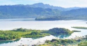
Fiji consists of 18,376 square km of land and includes about 330 islands (depending on how many reefs and tiny islets you take into consideration), of which about 100 are inhabited.
The territorial waters of Fiji are defined in the deed of cession as all that area ‘lying between the parallels of latitude of 15 degrees south and 22 degrees south of the equator, and between the meridians of longitude of 177 degrees west and 175 degrees east of the meridian of Greenwich’. In 1965 the boundary was extended by one degree to take in Conway Reef, extending the limit to 174 east. In latitude, the Fiji islands correspond with Tahiti, Townsville in Australia, Zimbabwe, Rio de Janeiro and northern Chile.

The area included within these limits is approximately 709,660 sq km, about 97% of which is water. The remaining 3% (18,376 sq km) is land. The Fiji archipelago includes about 300 islands (depending on how many reefs and tiny islets you take into consideration) of which about 100 are inhabited.
Fiji Islands Groups
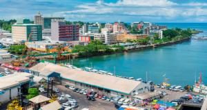
The largest island, Viti Levu, which has 70% of the population and an area of 10,388 sq km, is the hub of the entire archipelago. On it are Suva, the largest city, the chief port and the capital; Nadi, site of the international airport; and Lautoka, the second largest city and the second port of entry.
Vanua Levu, to the north-east of Viti Levu, is the second largest island which, with an area of 5538 sq km, is slightly more than half the size of Viti Levu. Although more sparsely settled than Viti Levu, it is also a center of population. Like Viti Levu, it produces sugar cane and also has large coconut plantations.
Taveuni lies to the east of Vanua Levu, being separated from it by the Somosmo Strait. With an area of 435 sq km, it is verdant, mountainous and agriculturally rich.
Tied with Taveuni as the third largest island in the archipelago (with an area of 409 sq km) is Kadavu, which lies to the south of Viti Levu. It is a center of traditional Fijian culture and not often seen by tourists.
All of the remaining islands of Fiji are small and are divided into two main groups, Lomaiviti and Lau. Lomaiviti translates as ‘middle’ or central Fiji, which describes exactly where this island group is on the map.
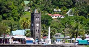
It is composed of seven main islands, with smaller ones lying off the coasts. Their aggregate land area is 425 sq km. Gau, Koro and Ovalau are large, each being about 100 sq km or more in area. Ovalau derives its importance from the town of Levuka, which was the earliest European settlement in Fiji and the original capital. Gau is the largest, highest and southernmost of the group; Koro is a high, wedge-shaped island rising abruptly from deep water.
Nairai and Batiki, to the east of Ovalau, are lower than their neighbors and are surrounded by extensive reefs. Makogai, north-east of Levuka, was once a leper colony serving the entire south-west Pacific. Wakaya, once a plantation, is now an exclusive real estate development. All of the islands can be seen from the old capital of Levuka on a clear day.
The Lau Group
Lau, or eastern Fiji, the area most heavily influenced by the Tongan culture, includes numerous limestone islands and others of volcanic or composite structure, all set among widespread reefs.
For administrative reasons all of Lau is one district, but it is geographically divided into four subgroups: northern Lau, central Lau and southern Lau (which together form a chain of islands stretching 432 km in a north-south direction), and the Moala group, lying to the south of Lomaiviti.
Northern Lau – Northern Lau includes the Exploring Islands (one large island and eight small ones, all enclosed within a barrier reef) and some 14 others of which Naitauba, Kanacea, Mago and Cicia are the most important.
Central Lau – Central Lau includes five islands centring on Lakeba, which is the hereditary seat of the chiefs of Lau and the home of Ratu Sir Kamisese Mara, the former prime minister.
Southern Lau – Southern Lau comprises 16 islands as well as some clusters, most of them grouped within 100 km of Lakeba. Beyond these, in the attenuated ‘tail’ of the archipelago, lie Vatoa and Ono, isolated from their nearest neighbors and from one another by wide stretches of open sea. The most outlying islands of southern Lau are actually closer to Tonga than they are to Fiji.
Moala Group
The Moala group is composed of three islands having an aggregate area of 119 sq km and situated about halfway between Kadavu and southern Lau. Moala is the principal island; Totoya is the rim of an extinct volcano whose breached and flooded crater forms a beautiful landlocked lagoon; and Matuku is reckoned to be one of the garden spots of Fiji.
Yasawa Group
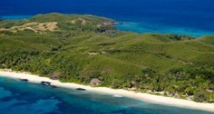
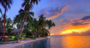
The Yasawa group, to the north-west of Viti Levu, includes six principal islands (four of them large) and many small ones, having a total area of 135 sq km. These islands, which have been compared to a string of pearls, extend across the sea for 80 km in shallow water behind the Great Sea Reef. This area is the destination for Blue Lagoon Cruises. It is a favorite of many tourists and lives up to the visitor’s idea of what the South Seas ‘should’ look like.
Rotuma, a Polynesian outlier 386 km north-west of the Fiji group, was ceded to Britain in 1881 as part of the colony of Fiji. Although politically part of Fiji, geographically and ethnologically it has nothing to do with the islands. Most Rotumans, who are Polynesians related to the Samoans, live on Viti Levu rather than their ‘home’ island. Rotuma’s policy is to discourage tourism.

The islands with which most visitors find themselves familiar are those of the Mamanuca group, also an archetypal ‘South Pacific’ locale, just offshore from Nadi and Lautoka on Viti Levu. It is here that many of the popular resorts such as Beachcomber, Plantation Island, Castaway and Mana are located.
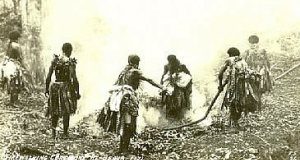
Some of the other smaller but well-known islands are Beqa, home of the firewalkers; Vatulele, famous for its sacred prawns; and Rabi, once inhabited by Fijians, but now the adopted home of Banabans or Ocean Islanders (Micronesians) who moved there after WW II (see the Other Ethnic Groups section later in this chapter). Both Beqa and Vatulele are off the southern coast of Viti Levu, while Rabi is off the coast of Taveuni.
Political & Administrative Divisions
Politically, the archipelago is divided into four areas or ‘divisions’: the Northern Division which is composed of Vanua Levu and the neighboring islands of Taveuni, Rabi and Qamea; the Western Division which consists of the western half of the main island of Viti Levu, including the Yasawa group to the north-west and Vatulele to the south; the Central Division made up of the eastern half of Viti Levu; and the Eastern Division, composed of the Lau, Kadavu and Lomaiviti groups.
Types of Islands
Sailors generally speak of ‘high’ and ‘low’ islands, but to be geologically correct there are three types of islands in the archipelago.
Volcanic Islands
The majority are high islands of volcanic origin and low islands which include coral and limestone varieties. The volcanic islands, of which Viti Levu is an example, have sharply defined, mountainous landscapes, ancient volcanoes and rocky outcrops and shores. Inland, the terrain is broken, with few stretches of flat land except in river valleys. In the windward areas where rains are frequent, the hills are covered with thick vegetation and are smothered almost incessantly with rain. Leeward, growth is sparse and hills are brown. Lively vestiges of the active volcanic period are hot springs, which are always found at low elevations. The best known in Fiji are the springs at Nakama, in the old coconut-plantation town of Savusavu on Vanua Levu.
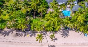
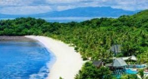
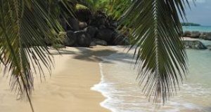
Coral islands, although low and small, have their own peculiarly Robinson Crusoesque charm. Generally located near the inner margin of a broad reef, they are usually only a few metres above sea level, are flat as a table and have beautiful white-sand beaches. Despite limited soil, they often support luxuriant vegetation including vines, grasses, broad-leaved trees and, of course, the coconut palm. A classic example is the resort on Beachcomber Island off Lautoka.
Limestone islands
Limestone islands may also appear to be low and flat-topped, but have steep, sharp sides suggesting that they are huge masses of rock heaved up from the sea. This is exactly what they are – often surrounded by a succession of precipitous cliffs, undercut by the surf. Because the limestone erodes easily, the rock may be pitted and bristling with sharp pinnacles or cut by ravines or narrow canyons. Inland, central depressions give the islands a basin-like appearance. The depression floors are commonly cut up into rolling hills, fertile and well wooded. A good example of a typical limestone island is Vanua Balavu in the Lau group.
Of the hundreds of islands in the Fiji group, only a few may be classed as true atolls. The typical atoll, of which so much has been written in the romantic literature of the South Seas, is basically long strips of broken coral and sand ranging from a few meters to half a km forming a circular or ring-like structure that surrounds a lagoon. Perhaps the best-known example of an atoll in Fiji is Wailagilala, on the eastern side of the Nanuku Passage, the main shipping lane through the islands.
- Coral Coast Fiji
- Kadavu
- Levuka, Fiji’s First Capital
- Mamanuca Islands
- Nadi, Denarau & Lautoka
- Pacific Harbour & Beqa Island
- Suva – The Capital of Fiji
- Taveuni – Fiji’s Garden Island
- The Sun Coast–Rakiraki & Nananu-i-Ra
- Vanua Levu (Savusavu & Labasa)
- Viti Levu-Gateway to the Fiji Islands
- Yasawa Islands
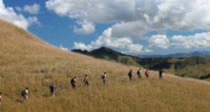
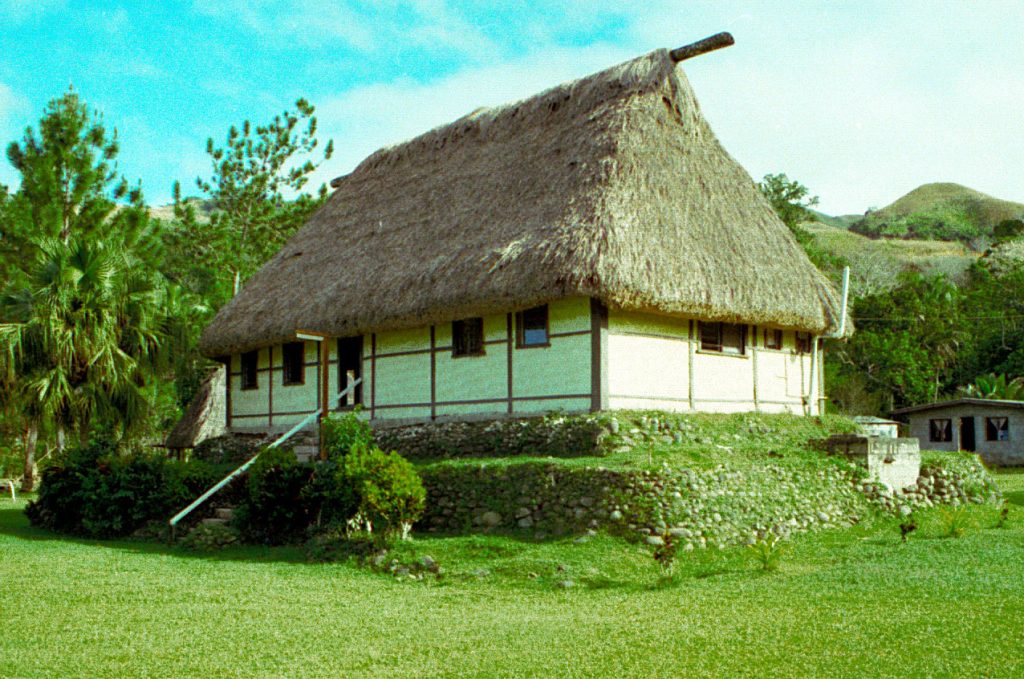
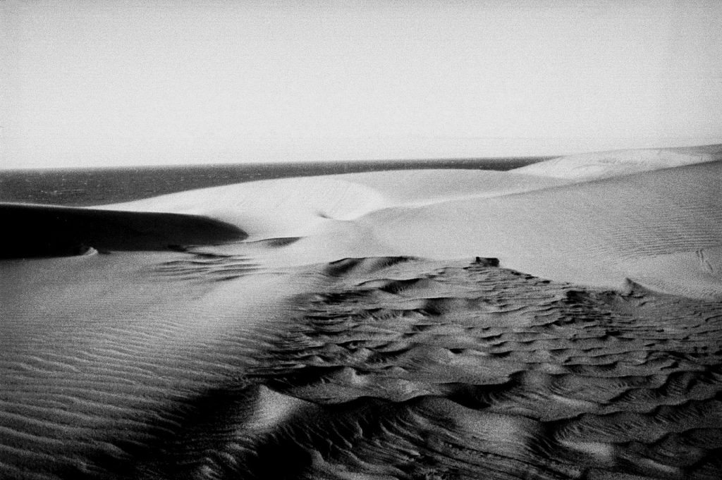
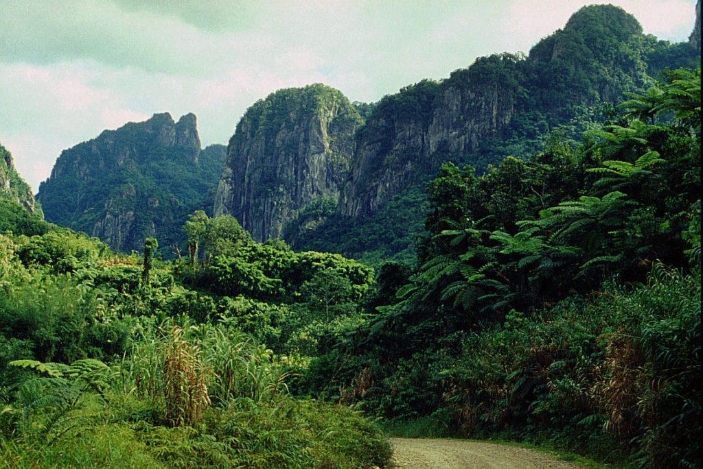
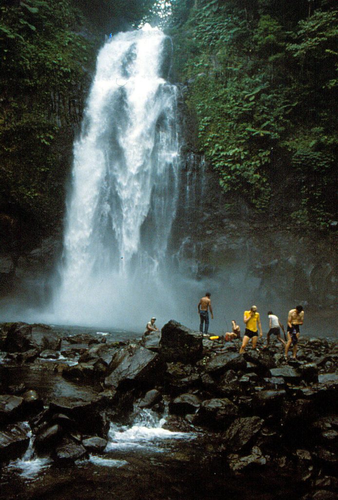
Hi Rob, hope all’s well. a few (4) of my photos here (with no credit) – Traditional house in Navosa (possibly Noikoro), the sand dunes at kulukulu (mouth of the sigatoka river), mountain scenery at Namosi, and, the the last one, was taken in Ravilevu forest reserve, with members of the NZ Maruia Society. Native Land Trust board and Forestry department reps spent quite a bit of time with them (and local villagers) on Taveuni, Ovalau, kadavu and Viti Levu (Koroyanitu, Sovi Basin in particular) undertaking survey work towards a system of forest parks and reserves for fiji. A key person in all of this was the late Alifereti Bogiva, then with Forestry.
ps. got back to fiji for a few weeks in 2018, spent time with relations in suva and tavua island (mamanuuca’s) and managed to visit a few old projects; including Bouma, Laven and the dunes. Put a few photos on my flickr site.